nPostednon January 13, 2014
n
n
n
n
n
n
n
n“Let’sncelebrate!”
n
n — “No!nThis is a horrible day to celebrate!”
n
nIncan think of several examples of holidays that some people enjoyncommemorating and others find offensive or sorrowful. For example,nsome Native Americans and others argue that Christopher Columbusnshould not be celebrated as a hero, and some even think thatncelebrating Thanksgiving is questionable because of the mistreatmentnof Native Americans by “the Pilgrims” and other European-bornnsettlers.
n
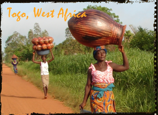
n Todaynis one of those questionable days in the African nation of Togo. Forncenturies Togo was part of the “Slave Coast,” a trading centernfor Europeans to obtain slaves; in the late 1800s German declarednTogoland a protectorate; and after World War II Togo became Frenchn“property.” In 1960 French Togoland became independent undernPresident Sylvanus Olympio. However, on this date in 1963, Olympionwas deposed by military forces, and when Olympio tried to reach thenU.S. embassy, he was shot and killed.
 Todaynis one of those questionable days in the African nation of Togo. Forncenturies Togo was part of the “Slave Coast,” a trading centernfor Europeans to obtain slaves; in the late 1800s German declarednTogoland a protectorate; and after World War II Togo became Frenchn“property.” In 1960 French Togoland became independent undernPresident Sylvanus Olympio. However, on this date in 1963, Olympionwas deposed by military forces, and when Olympio tried to reach thenU.S. embassy, he was shot and killed.
n
nItnis the winners who write the history books, many have said, and it isnthe winners who set up the holidays, too. The winners, in this case,ninclude the military forces under the leadership of EyademanGnassingbe. Gnassingbe ended up assuming the presidency several yearsnlater and ruled for 38 years, until his death, and it was hisngovernment that set up the holiday called “Liberation Day” fornthe day that he helped kick Olympio out of power and ended up killingnhim. Eyadema Gnassingbe’s son Faure is now the president and has beennsensitive enough to the people who don’t want to celebrate coups andnassassinations to call for the end of Liberation Day celebrations. n
n
n
nTogo’sntopography
n
 |
| Lome is the capital of Togo– and it’s on the Atlantic coast. |
n
nThentopography of a nation is the altitude, the various landforms, thennatural, physical features of the nation.
n
nTogonis long and skinny, squished between Ghana and Benin. As you can seenfrom this topographic map, Togo is divided roughly in half byna band of hills. The northern half has gently rolling savanna, andnthe south is a woodland plateau that slopes down to a coastal plainnwith lagoons and marshes. n
n
n
n
n
nAlsonon this date:
n
n
n
n
n
n
n
n
n
n
n
n
n
nPlannahead!
n
n
n
nPlannahead!
n
nChecknout my Pinterest boards for:
n
- n
-
nJanuaryn holidays
n
-
nJanuaryn birthdays
n
-
nHistoricaln anniversaries in January
n
n
n
n
n
n
n
nAndnhere are my boards for:
n
- n
-
n
-
n
-
nHistoricaln anniversaries in February
n
n
n
n
nn


